
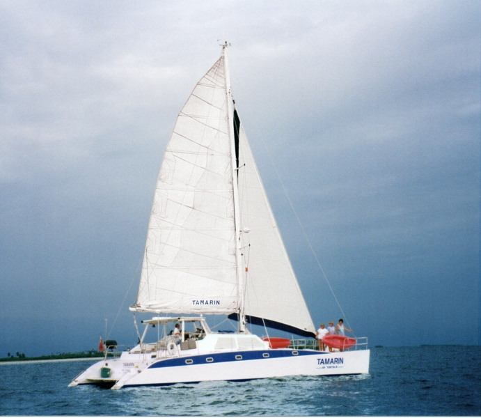
Tamarin sailing
Hurricanes can be devastating and disastrous. Over the years Whitey and I have had our share of disasters, most (but not all) from hurricanes. Each one is a story of it’s own.
One year, we thought we were being prudent by getting out of the Virgin Islands by early July and heading south for hurricane season. It was 1996 when we scheduled a charter in the St. Martin and St Barth’s region for the first two weeks of July. We were then planning on heading straight to the island of Grenada that is south of the hurricane belt.
The previous year, Hurricane Marilyn in September, 1995 had done tremendous damage to our charter catamaran, Tamarin of Tortola. The complete rebuilding of Tamarin in 4 months is another story. However, with insurance and the hard work of us, friends and the boat yard in Tortola, we were back in business by the end of January, 1996.
Now it was July of the same year and we felt we were making all of the right decisions as to location of the boat for hurricane season. Back then the start of hurricane season was July 1. Our insurance company said we were fine to be north of the 12 degree latitude but there would be a double deductible if damaged by a named storm. It is a tough call between keeping the business going and taking on charters but staying safe from hurricanes. This is a decision all yacht owners who are in the Caribbean make and everyone has their reasons for making their logistic decisions their way. (I know many will question how or why we did things). July is really early in the season for a named storm, so we thought we would be ok by being out of the northern part of the Caribbean chain by mid-July.
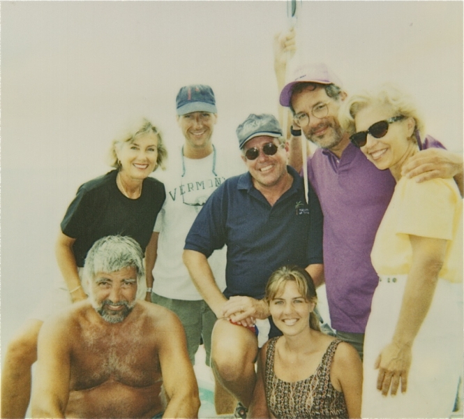
Tony, Joanne, Dean, Whitey, Chuck, Michele and Sarah – all happy to be safe and together
We picked up our repeat charter guests in St. Martin who were ready for their 2-week vacation with us. They were a fun group of six who had chartered with us the previous year in the BVI’s. We had already explored some of the islands, when on July 6th we pulled into the island of St. Eustatia, a little Dutch island nation located just south of St. Martin. Whitey went ashore to check us in to the country and one of the authorities mentioned to him a Tropical Storm was heading across the Atlantic. In that year, internet was in its infancy, particularly with WiFi on a boat. We monitored weather and storms by VHF radio and on Single Side Band radio. But somehow we had missed the report of this fast moving system.
The later reports stated that the storm was upgraded from a Tropical Depression to a Tropical Storm on July 6. It continued intensity as it moved across the ocean and entered the island chain between the islands of Antigua and Barbuda. We told our guests that we would monitor the storm throughout the night and make a decision of where to take the boat the next day. Whitey listened to updates on the a.m. radio all night, and at 3 a.m. decided we should return to St. Martin. We made a pot of coffee, woke up our guests, raised the anchor and made the fastest motor-sail we could for the 35 miles north-east to Simpson Bay Lagoon on St. Martin.
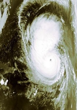
Hurricane Bertha – the eye of the storm
The seas were noticeably building as we approached the Simpson Bay Draw Bridge on the southern side of St. Martin. Whitey was calling the bridge operators on the VHF radio. It took a long time for someone to respond saying the bridge was closed to any more traffic as the operators had gone to take care of their own homes and family. This certainly made sense but did not help our situation.We dropped anchor just outside the entrance, loaded the guests with their luggage in the dinghy and took them to the nearest dock so they could find a hotel. I then got our fuel jugs from the boat to top up our tanks with diesel. Luckily we found a fuel dock that was still open. During that time, Whitey was plotting a course that would take us on a 90 degree path from the storm. We topped up the fuel tank with diesel and prepared the boat for a run from the hurricane. We checked the reef lines on the main, ran safety lines up both sides of the boat, and prepared a ‘ditch bag’ with water, some canned food and safety gear.
We were finally ready at 4:30 pm and began a heading of 185 degrees, just off south. We began the trip with full main sail, full genoa and the engine as we tried to make as many miles as we could by sunset. Just before sunset, we shortened the main by putting in two reefs and pulled the genoa in to only have about 60% of it out.
As we were passing to the east of Saba, we could hear a VHF conversation on Channel 16 between Tugboat Tiger and the weather station on Saba. Tiger was just a few miles ahead of us and was asking for information on the track of what was now being called Hurricane Bertha. The guy on the weather station said he was not getting good reports except ‘he had a cousin in Miami’ who said it had altered course and heading — South! When they finished their conversation, Whitey hailed the operator to confirm what we had heard. The operator asked who we were and our location. Whitey replied we were a 52 foot catamaran that was just passing Saba now. The operator said ‘Lordy, lordy, I hope you have a fast boat, Mon! Cause it be coming for you!’ It was at that point that we lost any radio contact. (We later learned that our antenna had broken loose from the wind and the pitching of the boat).
So there we were, no radio contact. No idea exactly where the storm was at that time or the path that it was taking. Did the guy mean that it had taken a hard left turn? Or that it was just veering towards the left so coming a little bit closer to us? Or? Or? We discussed our options and decided to stay with our plan and keep going south.
Whitey and I started getting a bit goofy. He was at the wheel so I grabbed the ditch bag. It already had some items in it but now it seemed a bit more serious. Did we have enough in the bag if we needed to abandon ship? So I added some more water, some juice cartons, some tools. I just kept adding to it. By the time I was done I could hardly lift the bag. It doesn’t help to have an emergency ditch bag if you can’t even lift it.
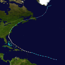
The track of Hurricane Bertha – July, 1996
It was now 9:00 pm and we were hand steering. The autopilot was not reacting fast enough in the big seas. Winds were sustained at 50 knots with the seas at least 15 feet high with the top breaking. We shortened the genoa even more, leaving just enough out to help maintain steerage. Whomever was at the help had to concentrate on the steering as we were surfing down the back of the waves and then had to steer into the trough so we would not hit the wave in front of us. We began the night with 3-hour watches each but then went to one hour each. The seas were too big and the ability to keep a steady course was too exhausting for more than an hour at a time. It was a very long night.
At the first light, we saw a freighter on the horizon. Whitey called him on our emergency handheld VHF, “Freighter heading south. This is the Catamaran Tamarin of Tortola to your north, please respond”. It took a while to get a response and when they did they said “what are you doing out here? Are you crazy?” Whitey explained our situation and why we were out here when a hurricane was just to the north. Did he have a report for us on the hurricane? He said that Hurricane Bertha had passed over St. Martin during the night and was on a northwest course.
We breathed a sigh of relief. That means that we had made it 110 miles south of St. Martin by the time it passed over the island. We slowed the boat down and slowly coasted as we gathered our wits. The storm was definitely moving away from us and we were out of danger.
We slowly turned the boat around and started the return trip back to St. Martin. We were so tired, slightly stunned but happy to be safe and alive.
As we were motor-sailing north, we saw an odd thing. A group of eight French Navy vessels passed us from east to west. A couple of them went ahead of us, a couple behind us. We attempted to reach them on the handheld VHF but there was no response. We could only assume that they had headed out to sea as well while the storm passed to the north.
As we passed Saba on the west side, we briefly thought we would be able to tie up to a mooring ball but the waves were too large as they crashed on to the shore. It was late afternoon when we dropped anchor in Marigot Bay on the north coast of St. Martin.
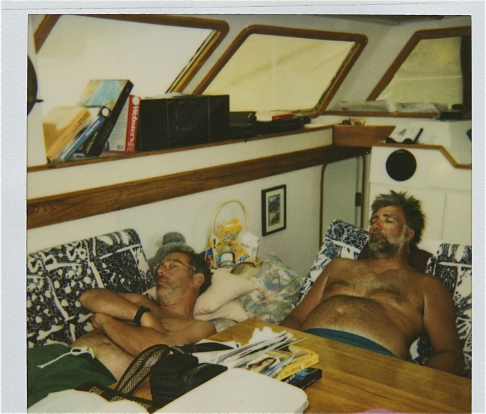
Chuck and Tony – resting after the ordeal
We got in the dinghy and went ashore. We were happy to be safe but were very concerned about our charter guests. Last we had seen them was when we dropped them off at the dock in Simpson Bay Lagoon in search of a hotel. We somehow found a local pay phone that worked and were able to reach one of the guests on his cell phone. It was a broken connection but we agreed to meet them at a certain location the next morning. Chuck and Tony, the two Dad’s of the group, met up with us. We said “where is every one else?” They said “are you serious? We wanted to hear what your plans are. We know you have had a very traumatic few nights and didn’t think you would want to deal with everyone”. We said “of course, we want everyone to come back to the boat!” Six adults had been in a small hotel room for 2 nights. They had been without electrical power and that means there is no running water or flushing toilets. Not a fun experience. On Tamarin everything is self-contained. Comfortable beds, water maker which means showers, electricity from the generator, air conditioning, food, ice and ALCOHOL!
Later that day the group came on board, we found a place to get some fuel and went to a nearby anchorage where we stayed 2 days for everyone to recuperate. The waters were very stirred up from the storm so diving and snorkeling wasn’t very good. But we were all together. Safe and sound on our nice comfortable boat.
We bonded that week with these two families. It’s difficult not to when you have been through such an ordeal. They continued to charter with us at each destination for the next five years and we still remain friends.







One thought on “RUNNING FROM THE STORM (ST. MARTIN)”